ShopDreamUp AI ArtDreamUp
Deviation Actions

HG Designs Subscriber Area
Lots of high resolution goodies for graphic design including textures, photoshop brushes, seamless patterns and more.
$8/month


Suggested Deviants


Suggested Collections


![[Bitmap Font] Retro Deco](https://images-wixmp-ed30a86b8c4ca887773594c2.wixmp.com/i/85c32342-1988-4891-a5bb-fb64a1a52683/d75k80v-89a47488-d9fe-4e4c-904b-638c48bfad87.png/v1/crop/w_150,h_150,x_0,y_0,scl_1,q_70,strp/_bitmap_font__retro_deco_by_pix3m_d75k80v-92s-2x.jpg)
![[Bitmap Font] Retro Deco](https://images-wixmp-ed30a86b8c4ca887773594c2.wixmp.com/i/85c32342-1988-4891-a5bb-fb64a1a52683/d75k80v-89a47488-d9fe-4e4c-904b-638c48bfad87.png/v1/crop/w_92,h_92,x_0,y_0,scl_0.61333333333333,q_70,strp/_bitmap_font__retro_deco_by_pix3m_d75k80v-92s.jpg)


You Might Like…


Description
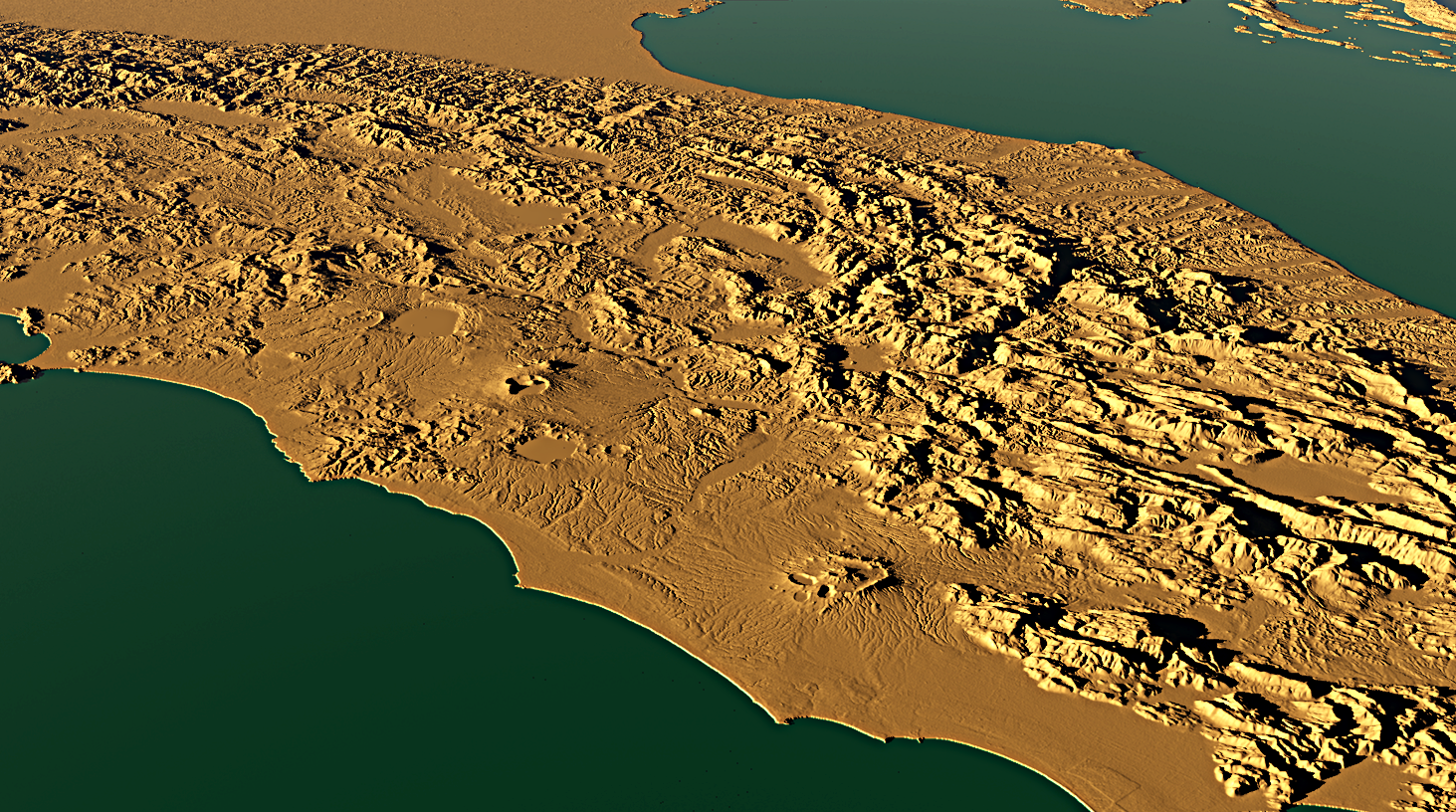
This image is a test render of a 5x5 degree quad from the Shuttle Radar Topography Mission (SRTM) database; the data were converted from the SRTM ASC file into a 16 bit TIFF file using some programs I am currently developing.
The quad contains 6000x6000 cell height values and is centered on the center of Italy (sorry for the tongue twister). The width of the area is about 500 kms and the the vertical elevations are highly magnified (the heightest mountain in the area is the Gran Sasso which is 2912 meters).
The quad contains 6000x6000 cell height values and is centered on the center of Italy (sorry for the tongue twister). The width of the area is about 500 kms and the the vertical elevations are highly magnified (the heightest mountain in the area is the Gran Sasso which is 2912 meters).
Image size
1463x816px 2.32 MB
© 2012 - 2024 jpb06
Comments0
Join the community to add your comment. Already a deviant? Log In